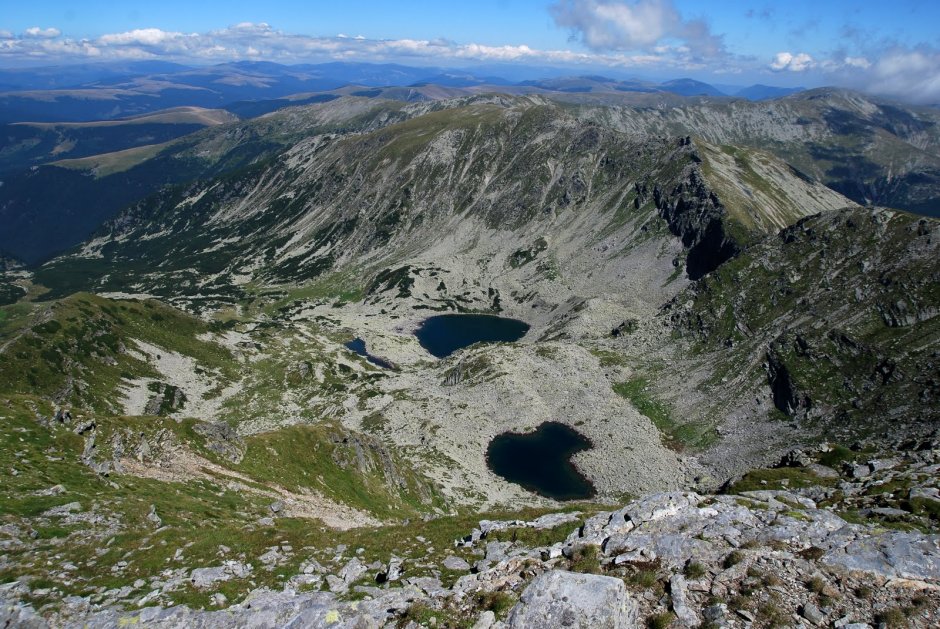
The red dot trail starts from Groapa Seaca Hut, together with the yellow cross trail and the red cross trail to Jiet Valley. Leave the lodge and follow DN 7A national road towards Petrosani until you reach the forest road along Jiet Valley. Turn left from the asphalt road and after about 350 meters the 3 trail markers split: the red dot trail continues on the road towards Agatat Mountain Hut, while the yellow cross and the blue cross trails veer to the right and climb towards Plaiul lui Dancila. The red dot trail follows the forest road along Jiet Valley, goes past a small dam located at the end of the dirt road, and then the path climbs through the forest along Rosiile Valley. After about 2 hours - 2 hours and 15 minutes, reach the clearing where you get to Agatat Mountain Hut and a sheepfold (which was not in use in September 2015). From the refuge, climb through an area with dwarf pines where you can either follow the path along the river or the one located on the right side of the river. Both are marked and will meet higher above, close to a sheepfold. Before you reach Zanoaga Stanei Lake, you have to walk past the sheepfold mentioned above and past the remains of a plane that crashed a few decades ago. Walk through the glacial corrie which hosts the lake and the section to Mandra Lake becomes quite difficult, as you have to walk on slabs and the trail markers are quite scarce. Orientation can be problematic in case of bad weather. First, the trail leads you past Lung Lake, where on an unmarked trail you can get to Rosiile Lake. The next lake, Mandra Lake, is believed to be located at the highest elevation in the Parang Mountains. From the shore, you can see the pillar on the main ridge and the path that climbs steeply, on debris, up to Gruiu Saddle. The last part of the trail, which is a northern-oriented slope, may be covered by snow until late spring.
Comments